Groups of Featured Photos
External Links
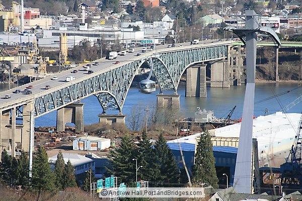
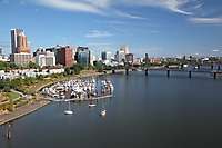
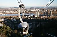
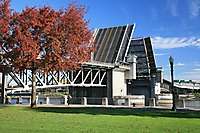
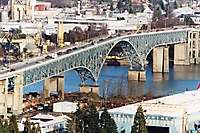
Portland Aerial Tram, Ross Island Bridge
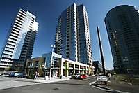
OHSU and Aerial Tram Dock, Portland
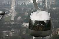
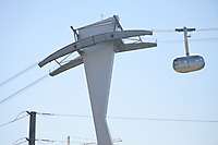
Portland Aerial Tram
Portland South Waterfront, OHSU, Aerial Tram
Portland Aerial Tram, OHSU
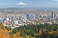
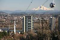
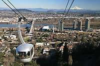
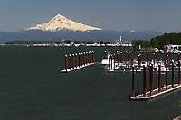
Portland Aerial Tram, Mt. Hood, Best Portland Pictures
Portland Aerial Tram, Mt. Hood
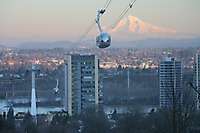
Portland Aerial Tram, Mt. Hood (2)
Portland Aerial Tram (2)
Portland Aerial Tram (3)
Portland Aerial Tram with Moon
OHSU and Aerial Tram Dock, Portland (2)
Portland Aerial Tram, Mt. Hood, Panoramic Pictures, OHSU
Portland Aerial Tram (4)
Portland Aerial Tram (5)
Portland Aerial Tram (6)
Portland Aerial Tram (7)
Portland Aerial Tram (8)
Portland Aerial Tram (9)
Portland Aerial Tram (10)
Portland Aerial Tram (11)
Portland Aerial Tram, Ross Island Bridge (2)
Portland Aerial Tram (12)
Portland Aerial Tram (13)
Portland Aerial Tram (14)
Portland Aerial Tram (15)
Portland Aerial Tram, Portland Buildings
Portland Aerial Tram (16)
Portland Aerial Tram (17)
Portland Aerial Tram (18)
Portland Aerial Tram, Mt. Hood (3)
Portland Aerial Tram, Mt. Hood (4)
Portland Aerial Tram (19)
Portland Aerial Tram, Mt. Hood (5)
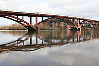
Portland Aerial Tram, Marquam Bridge
Portland Aerial Tram (20)
Portland Aerial Tram (21)
OHSU from Aerial Tram
Portland Aerial Tram (22)
Portland Aerial Tram (23)
Portland Aerial Tram (24)
Portland Aerial Tram (25)
Portland Aerial Tram (26)
Portland Aerial Tram (27)
Portland Aerial Tram (28)
Portland Aerial Tram, Mt. Hood (6)
Portland Aerial Tram (29)
Portland Aerial Tram (30)
Portland Aerial Tram (31)
Portland Aerial Tram (32)
Portland Aerial Tram (33)
Portland Aerial Tram (34)
Portland Aerial Tram (35)
Portland Aerial Tram (36)
Portland Aerial Tram (37)
Portland Aerial Tram, OHSU (2)
Portland Aerial Tram (38)
Portland Aerial Tram (39)
Portland Aerial Tram (40)
Portland Aerial Tram (41)
Portland Aerial Tram (42)
Portland Aerial Tram (43)
Portland Aerial Tram (44)
Portland Aerial Tram (45)
Portland Aerial Tram, Mt. Hood (7)
Portland Aerial Tram (46)
Portland Aerial Tram (47)
Portland Aerial Tram (48)
Portland Aerial Tram (49)
Portland Aerial Tram (50)
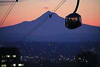
Mt. Hood reflection on Tram, with Mt. St. Helens
Portland Aerial Tram (51)
Portland Aerial Tram (52)
Portland Aerial Tram (53)
Portland Aerial Tram (54)
Portland Aerial Tram (55)
Portland Aerial Tram (56)
Portland Aerial Tram (57)
Portland Aerial Tram (58)
Portland Aerial Tram (59)
Aerial Tram reflection in building
Portland Aerial Tram (60)
Portland Aerial Tram (61)
Portland Aerial Tram (62)
Portland Aerial Tram (63)
Portland Aerial Tram (64)
Portland Aerial Tram (65)
Portland Aerial Tram (66)
Portland Aerial Tram (67)
Portland Aerial Tram (68)
Portland Aerial Tram (69)
Portland Aerial Tram (70)
Portland Aerial Tram (71)
Portland Aerial Tram (72)
Portland Aerial Tram (73)
Portland Aerial Tram (74)
Portland Aerial Tram, South Waterfront
OHSU and the Aerial Tram, from Ross Island Bridge
Portland Aerial Tram (75)
Portland Aerial Tram, From Ross Island Bridge
OHSU, South Waterfront, Aerial Tram
Portland Aerial Tram (76)
Portland Aerial Tram (77)
Portland Aerial Tram (78)
Portland Aerial Tram from Ross Island Bridge
Portland Aerial Tram (79)
OHSU, Portland Aerial Tram, Fall Leaves
Oregon Health Sciences University (OHSU), Portland Aerial Tram, Fall Leaves
Aerial Tram, OHSU South Waterfront
Aerial Tram, OHSU South Waterfront (2)
Aerial Tram, OHSU South Waterfront, From Gibbs Pedestrian Bridge
Portland Aerial Tram, Mt. Hood (8)
Portland Aerial Tram, Portland Steetcar at South Waterfront
Portland Aerial Tram (80)
Lair Hill with Portland Aerial Tram cars, upper right
Lair Hill with Portland Aerial Tram cars, upper right (2)
Lair Hill with Portland Aerial Tram cars
Portland Aerial Tram (81)
Portland Aerial Tram (82)
Portland Aerial Tram (83)
Portland Aerial Tram (84)
Portland Aerial Tram (85)
Lair Hill with Portland Aerial Tram cars, upper right (3)
OHSU and Portland Aerial Tram Car, construction
Portland Aerial Tram (86)
Portland's OHSU Aerial Tram with Mt. Hood
Portland's OHSU Aerial Tram with Mt. Hood (2)
Portland's OHSU Aerial Tram with Mt. Hood (3)
Portland's OHSU Aerial Tram with Mt. Hood (4)
Portland's OHSU Aerial Tram with Mt. Hood (5)
Portland's OHSU Aerial Tram with Mt. Hood (6)
Portland's OHSU Aerial Tram with Mt. Hood (7)
Portland's OHSU Aerial Tram
Portland's OHSU Aerial Tram (2)
OHSU Aerial Tram, Portland
Portland's OHSU Aerial Tram with Mt. Hood (8)
Portland's OHSU Aerial Tram (3)
Portland's OHSU Aerial Tram with Mt. Hood (9)
Portland's OHSU Aerial Tram with Mt. Hood (10)
OHSU in the snow; Veteran's Hospital; Aerial Tram, West Hills
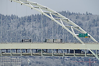
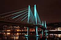
Portland Aerial Tram in the Snow
Portland Aerial Tram in the Snow (2)
Portland Aerial Tram, OHSU, South Waterfront, in the Snow
OHSU, Aerial Tram
Portland Aerial Tram, OHSU (3)
Portland Aerial Tram, OHSU (4)
Portland Aerial Tram, Mt. Saint Helens