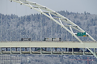
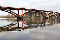
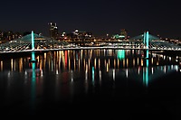
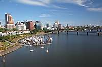
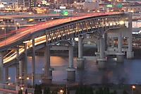
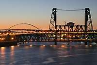
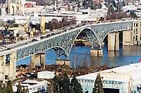
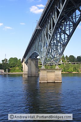
Ross Island Bridge from Portland Spirit, Willamette River
![]()
|
![]() |
Image is copyrighted and may not be copied or used without permission.
Location: Portland, Oregon
Ross Island Bridge: The Ross Island Bridge was designed by Gustav Lindenthal, a world-famous
and veteran bridge designer [1], after a scandal in the 1920's that also
involved the Burnside Bridge and Sellwood Bridge, which were constructed
at roughly the same time.[2]
Finished in 1926, the Ross Island Bridge connects to Arthur Street directly
on the west approach and to Powell Boulevard on the east approach.
This is also U.S. Route 26 that becomes the Sunset Highway on the west
side and goes out to Mount Hood on the east side.
The Ross Island Bridge has, for vehicles, the most awkward, unusual approaches
of all the Portland bridges. Perhaps this is because, prior to the
opening of the two modern Interstate highway bridges (the Marquam and Fremont)
in the late 60's and early 70's, the Ross Island handled the bulk of the
traffic across the river at the south part of downtown Portland. The east side connects to McLaughlin/Hwy 99E
and Powell Blvd, while the west allows access to Barbur Blvd, I-5, and
I-405.
In any case, to get on to the Ross Island Bridge from either side of
the river, you often have to follow signs and follow several turns. You
feel like you're driving around in circles just to get on! To give
drivers entering the bridge priority, they often can turn right or left
without a stop sign, wheras direct traffic has to top. Unaccustomed drivers
entering the Ross Island Bridge often expect stop signs at these places
and stop.
You can walk across this bridge - there is a walkway but no railing,
and the cars go by pretty fast, so be careful! But the bridge does
not get nearly the foot traffic as, say, the Hawthorne, does, because the
Ross Island is at the south part of downtown, and the complicated west
side approaches are not designed well for pedestrians.
References:
[2] Petroski, Henry. Engineers of Dreams: Great Bridge Builders
and the Spanning of America. New York: Alfred A. Knopf,
1995. P. 193..[1] Smith, Dwight. Historic Highway Bridges of Oregon. Second
Edition. Portland, Oregon: Oregon Historical Society, 1989. P. 78.
| PhotoID D300CRW07845 Specifications: | |
| Size: | 1440x2160 pixels, 300DPI up to 4.80" x 7.20" |
| Largest Print Size: | Great Prints up to 16"x24" in size (larger may still be acceptable in some cases) |
| Camera Exposure/Specs: | 1/90 Sec, f8.0, ISO 200, Lens 28.0 to 135.0 at 28mm |
| Shoot Time/Day: | 07/17/2002 - 17:32 PST |


